New Mexico Geological Society · Socorro, NM
(575) 835-5410

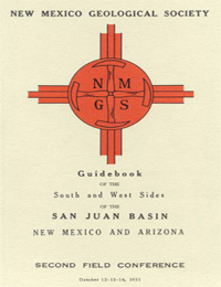
Clay T. Smith and Caswell Silver, eds, 1951, 163 pages, (Reprinted 1996). https://doi.org/10.56577/FFC-2
Research papers are free to download.
Roadlogs, mini-papers and some other sections are available in print.
The San Juan Basin which is roughly circular, includes much of north western New Mexico a narrow strip of north east Arizona, and a zone 25 miles wide in southwestern Colorado, or a total area of almost 20,000 square miles.The greater part of the basin is drained by the San Juan River, but much of the south and west sides is drained by the tributaries of the little Colorado river. The extreme southwestern corner is within the watershed of the Rio Grande. Except for badland surfaces in areas of Teritiary sediments, the inner portion of the basin is charecterized by shallow, open valleys separated by broad mesas or by low cuestas. In regions of Cretaceous and older rocks the surface is more varied in appearance. Prominent hogbacks follow the margins of the basin and are sharp ridges where dips are steep as along the north side. Maximum altitudes along the south and west sides of the basin rarely exceed 9,500 feet and a maximum relief of 5,000 feet is noted at Mount Taylor. The first day road log is in two parts. The first part is from Albuquerque to Grants with side trips to Los Lunas and El Rito. The second part is a 27 mile loop through the east end of the Zuni Mountains. The second day road log is from Grants to Gallup via Bluewater Lake, Smith Lake, Crownpoint, and Pinedale. This trip continues the section in the Zuni Mountains. The route allows the caravan to observe lateral variations and complex intertonguing between the Mancos and Mesaverde formations along the south side of the San Juan Basin. Coal beds and structures in the Gallup Basin will be seen late in the day. The last stop will be near the southern end of the Defiance uplift before returning to Gallup. The third day road log is from Gallup to Lupton, Window Rock, Todilto Park, Lukachukai, Red Rock and Ship Rock. This trip traces the changes in the Permian, Jurassic and Cretaceous rocks along the state line between Lupton and Lukachukai Trading Post.
Note — Downloads of the papers below are free.
Road logs, mini-papers, and some other sections of recent guidebooks are only available in print.
(includes Dedication, President’s Message, & Conference Organizer’s Message)
Download PDF ↓(484 KB PDF)
C. T. Smith, pp. 9-10.
Vincent C. Kelley, Wood, G. H., Jr., Caswell Silver, and C. T. Smith, pp. 11-32.
Clay T. Smith, E. C. Beaumont, and J. W. Harshbarger, pp. 33-57.
Charles B. Read, W. B. Hoover, and C. A. Repenning, pp. 58-79.
Charles B. Read, pp. 80-84.
Edwin D. McKee, pp. 85-92.
Anonymous, pp. 93.
Lawrence C. Craig and Clifford N. Holmes, pp. 93-95.
J. W. Harshbarger, C. A. Repenning, and R. L. Jackson, pp. 95-99.
Clay T. Smith, pp. 99-103.
Caswell Silver, pp. 104-118.
Eugene Callaghan, pp. 119-123.
Vincent C. Kelley, pp. 124-131.
Frank C. Barnes and Emery Arnold, pp. 132-140.
Robert A. Bieberman and Mona Clarich, pp. 141-146.
Halpenny, Leonard, C., pp. 147-154.
Frank C. Barnes, pp. 155-160.
A. L. Duff Jr. and J. V. Fritts, pp. 161-163.
Caswell Silver and W. B. Hoover, scale 1:633,600.